KATHMANDU: Chinese scientists have released new findings on the devastating ice-and-rock avalanche and subsequent flood and debris flow that struck the Nepal-China border region last week, saying the disaster was not caused primarily by intense rainfall immediately before the event.
A joint study led by the Institute of Tibetan Plateau Research under the Chinese Academy of Sciences found that a large mass of ice and rock fell from a high-altitude area north of Langtang Lirung in Nepal on Aug 26 in the Nepali calendar.
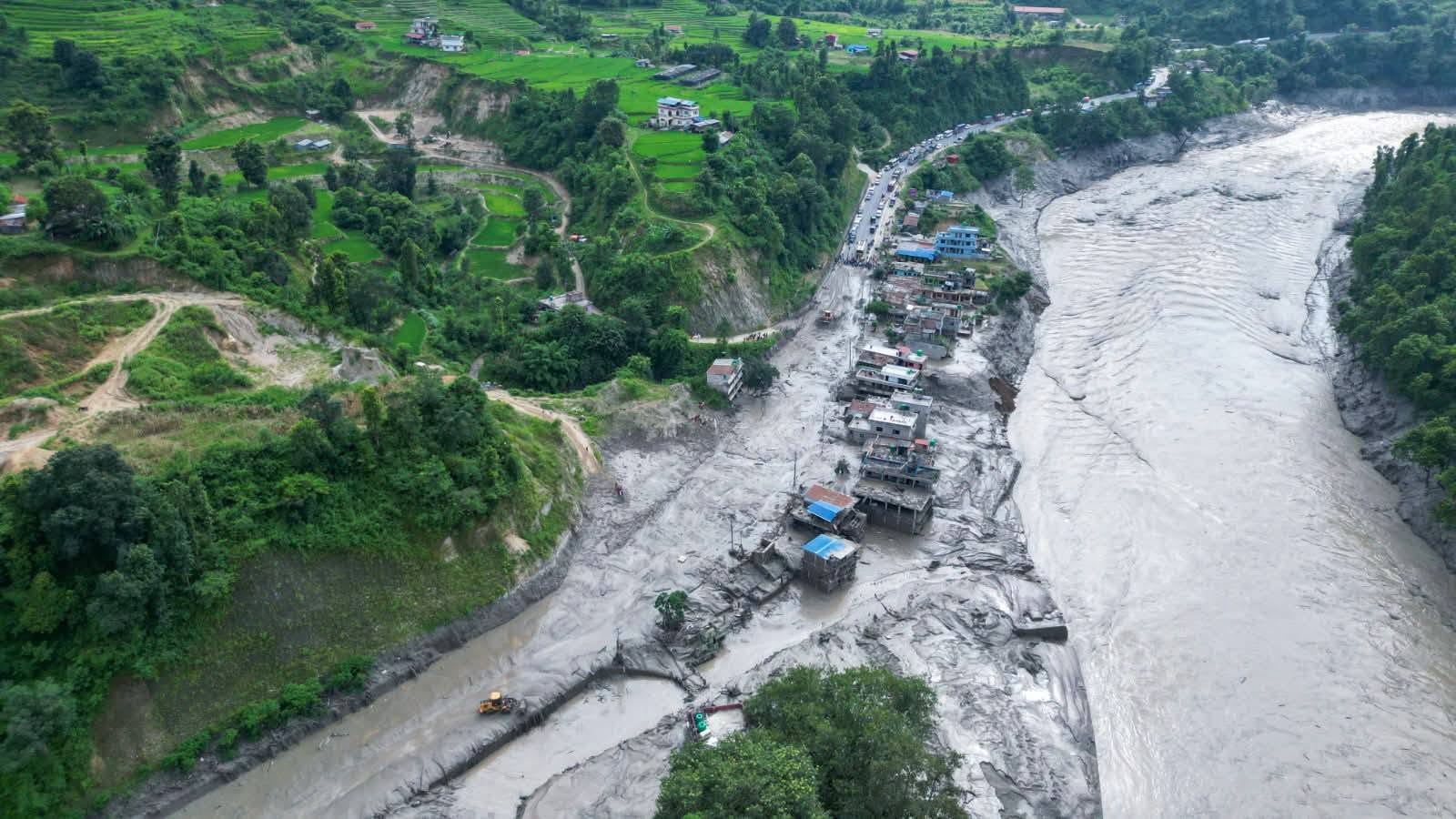
The rapidly moving mass swept down a deep gorge, picking up additional soil, rocks and other material along the way before eventually turning into a huge debris flow that caused damage at Kerung port in Tibet, according to China’s state news agency Xinhua.
The Tibetan Plateau Data Center of the Chinese Academy of Sciences began investigating the disaster soon after it occurred.
Researchers combined satellite imagery, topographic data, records from seismic monitoring stations, surveillance-camera footage and other video material to reconstruct and assess the sequence of events.
Their analysis suggests that rainfall in the source area had been below normal for several months before the disaster.
There was also no exceptionally heavy rainfall immediately before the event.
Instead, the researchers pointed to a combination of longer-term changes in the high-altitude environment.
They found that the glacier had been moving relatively rapidly for years, while ice had continued to accumulate towards its terminus.
At the same time, temperatures during the preceding spring and summer had been higher than normal.
These conditions are believed to have increased the rate of snow and ice melt and weakened the permafrost in the high-altitude area.
As a result, the stability of the interfaces between ice and rock may have gradually deteriorated, potentially leaving the glacier increasingly unstable before its sudden collapse, the scientists said.
They stressed, however, that there is not yet enough evidence to establish the immediate and definitive trigger for the collapse.
The available evidence does indicate that the disaster cannot be explained simply as the result of a short period of exceptionally heavy rainfall.
The researchers also found that the scale of the disaster was determined not only by the amount of ice and rock that initially collapsed, but also by the large quantities of material picked up as the mass travelled downstream.
The initial ice-and-rock mass travelled about 22km through a deep gorge.
During that journey, it eroded the riverbed, river banks, surrounding slopes and other terrain, incorporating large amounts of soil and rock into the moving mass.
Once mixed with river water, the original ice-and-rock avalanche transformed into a huge, highly destructive debris flow.
According to the study, this process of progressively incorporating additional material was not simply a secondary consequence of the initial collapse.
It played a critical role in determining the intensity of the disaster by the time the debris reached Kerung port.
Researchers also identified unusual signals in the source area several hours before the main avalanche.
Records from seismic monitoring stations showed several distinct anomalies before the major event.
Some of those signals occurred at roughly the same time as small movements of ice and snow observed at the site.
The researchers believe these may indicate that smaller ice and snow failures or material collapses occurred before the much larger avalanche.
They said the signals should be examined further using data from multiple seismic monitoring stations, acoustic records and video footage.
Such analysis could help scientists better identify the short-term processes that precede instability in high-altitude glaciers and could provide new evidence for developing early-warning systems.
The study also has wider implications for assessing disaster risks in high-altitude and cold regions affected by climate change.
Scientists said risk assessments should not focus solely on estimating how much material could initially fall from a mountain or glacier.
They should also consider how much additional soil and rock could be eroded and incorporated as the material moves through valleys and gorges, as well as the settlements and critical infrastructure located along its path.
In other words, understanding the potential scale of a disaster requires looking at the entire chain of events—from the stability of the source area and the initial collapse to the additional material gathered downstream and the people and infrastructure exposed along the route.
The researchers described the incident as a clear example of how instability in a high-altitude glacier can rapidly develop into a devastating debris flow through erosion and the incorporation of additional material.
They said the findings could provide a scientific basis for post-disaster rescue operations, damage assessments and reconstruction.
They could also support cross-border disaster monitoring, early-warning systems, risk assessment, and joint prevention and emergency-response efforts across the Himalayan region.